Palo Alto
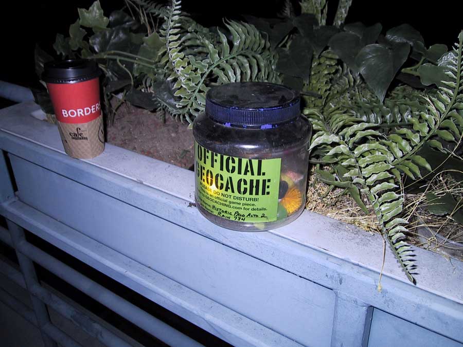
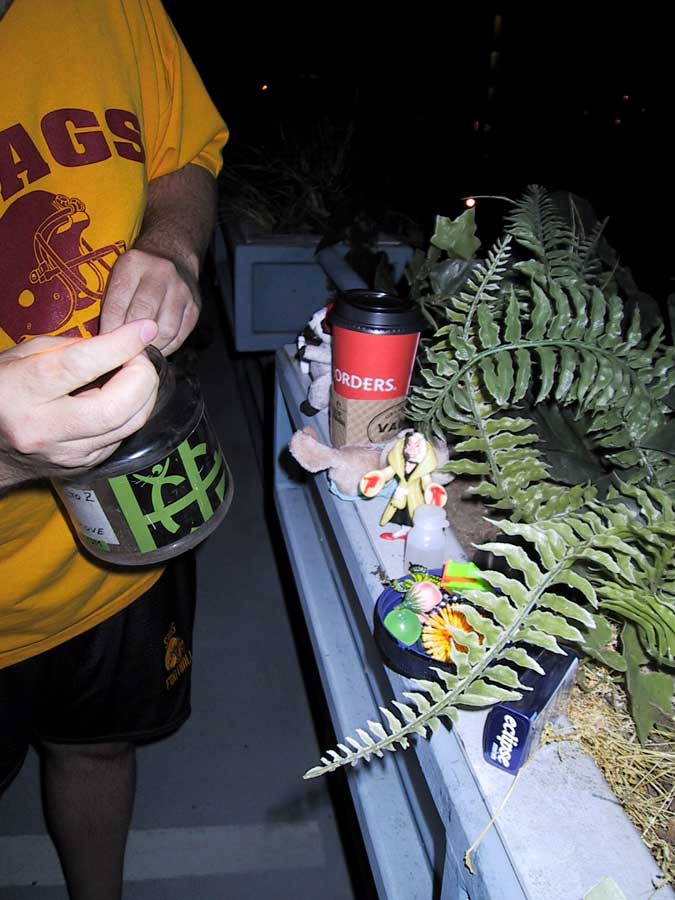
We just got back from S. California and we spent the day with Linda talking about our trips. We headed to Palo Alto for dinner at La Morenita and decided on doing a Multi-Cache on some historical information on Palo Alto. The 3 of us had talked about doing this one before, so this was the perfect opportunity. This was similar to the cache we did in Yosemite where in order to find the bonus cache, you had to get information from previous coordinate locations. It was fun since it took us on a mini-tour of the historic buildings around downtown Palo Alto. Plus, it was a lot of fun getting a physical cache at the end! This was Linda's first physical cache, so she picked what we would leave and take. We left an unopened tin of extra mints and took a tiny raccoon stuffed animal. The physical cache was at the top of a parking garage. We parked 2 stories down because the last 2 levels had a gated entrance. The gate was open, but we didn't know if it would close on us while we were up there so we decided not to risk it and walked up. It was very dark up there since it was 10:20pm, and the parking structure lights were turned off but we had a flash light and managed to find it easily. The GPS took us right to it! As we were wrapping up, a car came up the ramp so we quickly stashed the cache and went on our way. It was just a young couple, who parked at the other end of the structure, and they were much more interested in themselves to pay attention to us.
|
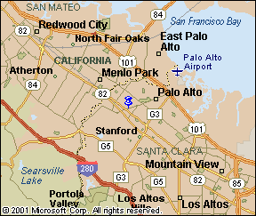
Historic Palo Alto 2 N 37° 26.360 W 122° 09.237 link to the geocaching website This combined Virtual and Regular multi-Geocache takes you on a flat, 1.5-mile tour of Old Palo Alto as you seek out various historical markers. It does not require any backtracking and will provide a glimpse into the history of this city which was incorporated in 1894. At each of the locations, the historical marker will answer a question posed for the Virtual Cache. In addition, information to determine one digit of the Bonus Cache coordinates will be provided. Upon completion of the tour, e-mail the answers to the questions to log the Virtual cache. I’ll respond within a day or so unless we are traveling. If you also find the Bonus Cache, it is not necessary to e-mail the answers for the Virtual Cache portion of the search. Note: You can use a car for the first two locations because these are in residential areas with easy parking. The remaining locations are in the downtown area and are most easily reached by walking. If you don’t find on-street parking, try the Cowper Street parking garage located behind the California Pizza Kitchen on Cowper Street between Hamilton and University Avenues.
Loc. 1:
37-deg. 26.360-min. North, 122-deg. 09.237-min. West
Note: This area, bounded by Ramona, Addison, Waverley, and Kingsley Streets, still features many of the original shingle-sided large homes.
Loc. 2:
37-deg. 26.575-min. North, 122-deg. 09.270-min. West
Loc. 3:
37-deg. 26.765-min. North, 122-deg. 09.552-min. West (This one is not a
historical marker)
Note: Check out the fine example of a Meta Sequoia (Dawn Redwood) on the East side of the building and a Greg Brown wall painting on the West side. There is another wall painting on the Northwest corner of Bryant and University.
Loc. 4:
37-deg. 26.740-min. North, 122-deg. 09.661-min. West
Loc. 5:
37-deg. 26.948-min. North, 122-deg. 09.645-min. West
BONUS CACHE:
There regular cache contains trinkets to exchange: 37-deg. 26.AB5-min.
North, 122-deg. 09.DE3-min. West
If you locate the Bonus Cache, be sure to indicate that when you log this on the Geocaching website.
OPTIONAL
additional site you might want to check out:
Note: The man after whom this place is named was Palo Alto’s first weatherman. |
My picture quality is poor since all of these were taking after sunset or while it was totally dark.
(click on image to view larger size)
|
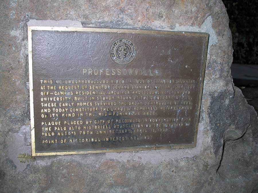
Location 1: Professorville This subdivision was created by Thomas Hopkins in 1889 A=9 |
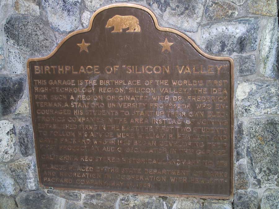
Location 2: Birthplace of Silicon Valley In 1938, Hewlett and Packard started their first product, an Audio Oscillator at this location. D=1+3 D=4 |
Location 2: The garage where Hewlett and Packard started. |
|
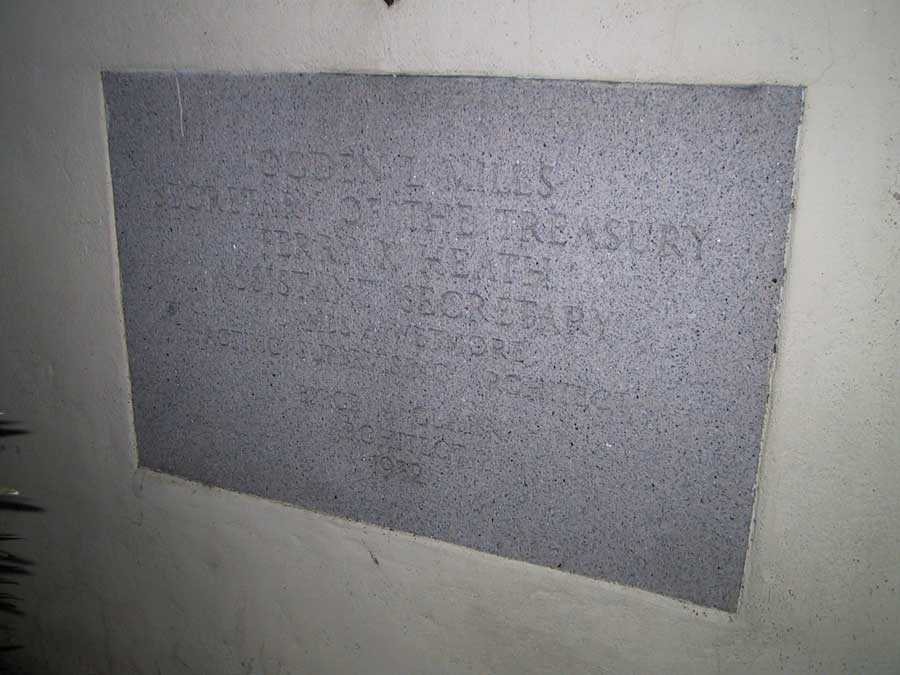
Location 3: Palo Alto Post Office The architect was Birge M. Clark built in 1932 B=3-2 B=1 |
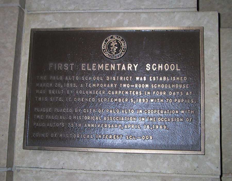
Location 4: First Elementary School Opened for operation on Sept. 5, 1893. E=9 |
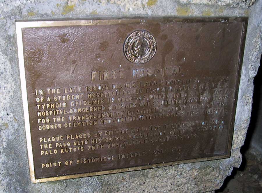
Location 5: First Hospital |
|
Bonus Cache!! At: N 37* 26.915 W 122* 09.493 |
|
|
|
Our Log:
|
 |