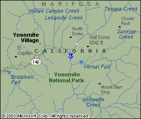
Yosemite

back to geocaching homepage


May 21, 2004

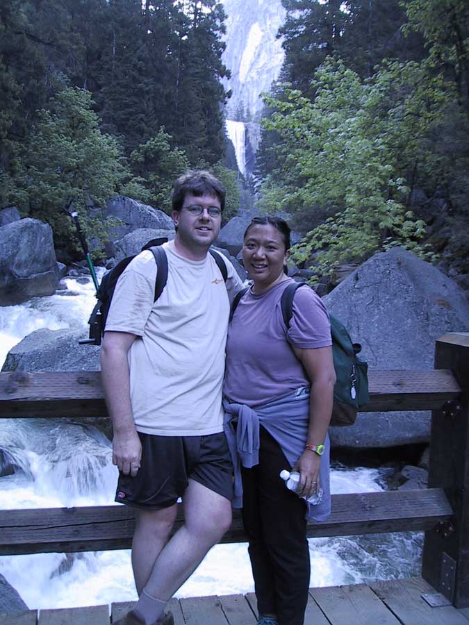
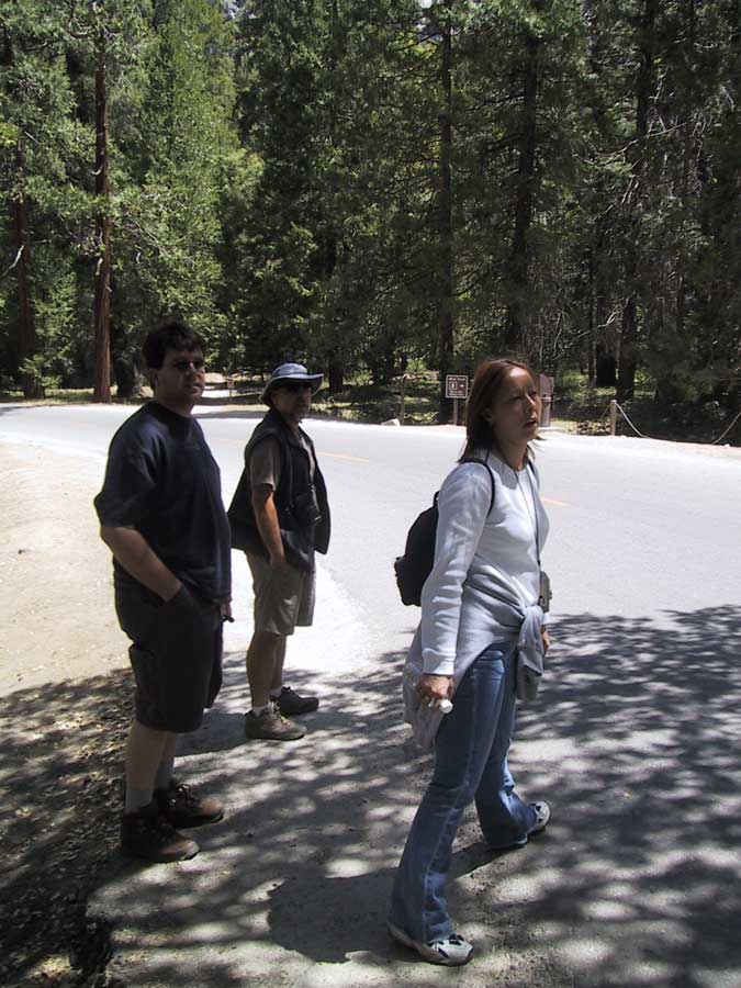
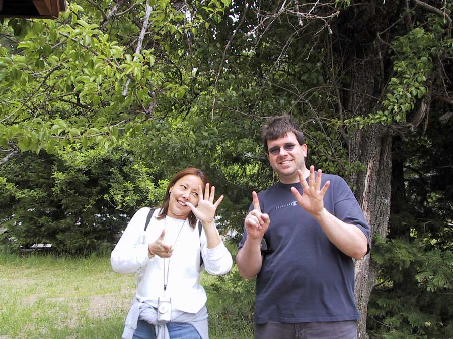
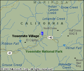
This was such an amazing weekend! We arrived in Yosemite Thursday night with our friend, Linda. We were all staying at the Curry Village. Friday morning, Jimmy, Linda and I had breakfast with Eric, Lauree, Jim, Bambi, Dave, Nancy, Terry, Amy at the Curry Dining Pavilion. Around noon, everyone split up to do their own adventures. Eric stayed in the village to wait for everyone to come in. Dave Retz went out exploring on his own. Terry and Amy went up to Glacier Point. Lauree, Jim, Bambi, Dave, Linda, Jimmy and I all headed to the Happy Isle trailhead. For our first geocache today, all 7 of us helped to find it: A Happy Place. We introduced Bambi and Dave to geocaching. Lauree, Jim and Linda have heard about our previous adventures so they were curious about what it entails.

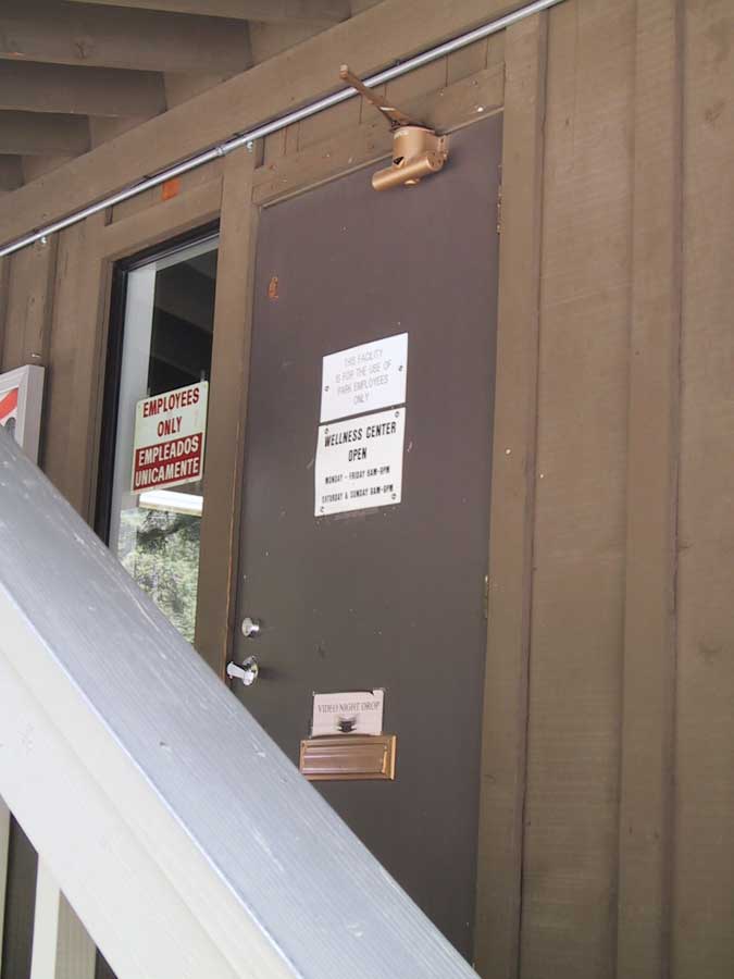
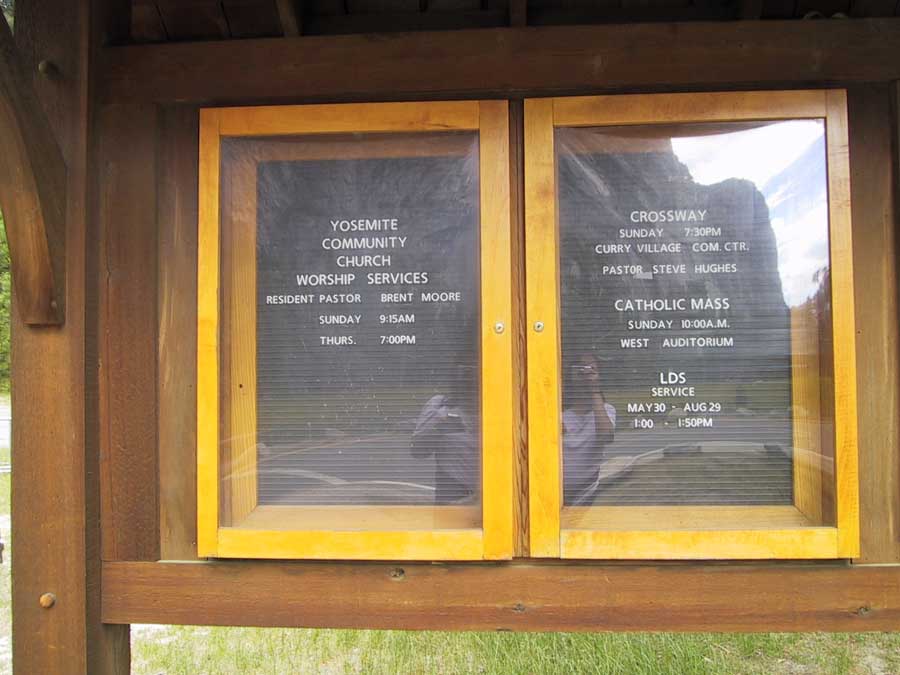
Since Yosemite is a National Park, there are no physical caches allowed in the park, so all of the geocaches we did this weekend are called virtual geocaches, which means you need to find the answers to something rather than a container.

The text in the smaller font is information from the geocache owner.
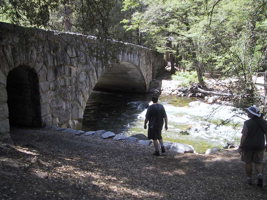
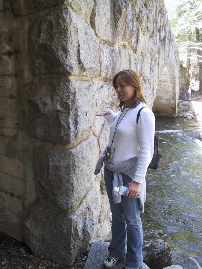
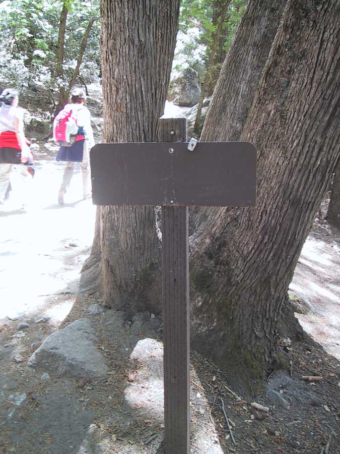

A Happy Place
N 37° 43.959 W 119° 33.503

link to the geocaching website

This is a beautiful geocache location with a fun challenge.

I like things that are happy. This is a happy place despite some recent local disasters.

The structure you are standing on is still in good shape despite a nearby massive rockfall and windblast in the Happy Isles area that damaged the nearby Happy Isles Gauging Station Bridge in July 1996. Then a major flood in January 1997 caused extensive damage to human-made structures along the main stem of the Merced River, including that same Happy Isles Gauging Station Bridge. That bridge was removed for safety reasons and the Gauging Station will be relocated in the future.

Huge rocks were embedded in the trunks of hundreds-year-old trees, as if the trees were mere clay. Giant trunk carcasses were strewn about as if they were straw.

But this structure you are standing on survived it all unscathed.

Enjoy the view and enjoy the cache hunt.

TO GET CREDIT FOR THIS VIRTUAL CACHE, EMAIL TO ME ANSWERS TO THE FOLLOWING QUESTIONS:
1. Who loved Joey in July of 2003.
2. During the flood of 1997, on what date was the high water marked.
3. How high up your body was the water on that date. (You can give an approximate measurement or tell me which part of your body would have been above the water.

After you email me your answers, go ahead and log your find. Please do not enter the answers in the logs.

Please remove any trash you find in the area.


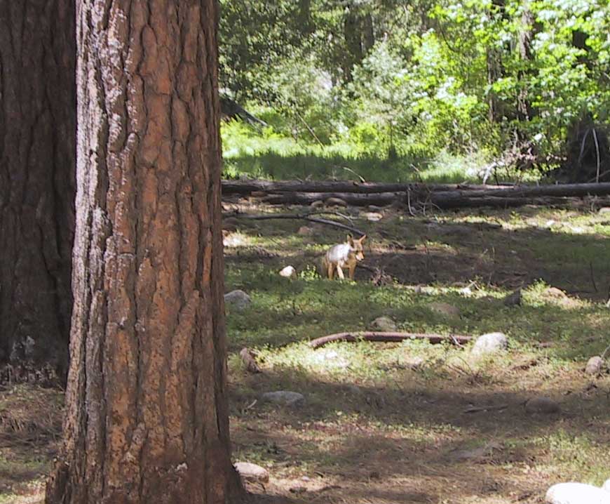
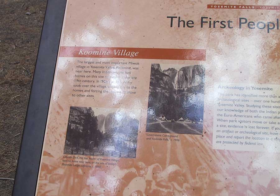
Linda, Jimmy and I started hiking to the Happy Isle trailhead from Curry Village and coincidentally ran into Lauree, Jim, Bambi and Dave when we arrived. When we met up with them, we also saw a coyote! He was completely un-phased by us and just strolled along as if our presence was normal. Since they were with us, they all decided to stay and help us find our first geocache of the day. We also ran into 2 other cachers looking for this

Coyote

On the bridge, approximately where the coordinates point

View from the bridge

Jimmy, Jim and Linda

looking for the answers

Answer to question #1

Answer to question #2

Answer to question #3

Linda and Jimmy check out the rocks embedded into the trees.

(above them on the bridge are other geocachers looking for the same cache.)

Our Log:

 May 21 by jretz (16 found)
Walked in from Curry Village, enjoying the cool weather. We had a team of 7 of us for this cache, 5 who had never geocached before! We enjoyed having them with us and perhaps turned them into cachers as well!
While we were standing on this structure, we ran into 2 other cachers: geo_hiker. This was the first time we've ran into other geocachers so it was fun chatting with them a bit.
Thanks!


Split Rock: An Investigation

N 37° 43.854 W 119° 33.509

link to the geocaching website

This is a marvelous opportunity to see a large boulder close up just after it has had a major slab split from it.

"Sometimes rocks weather by peeling off in sheets rather than eroding grain by grain. Exfoliation is scientific Latin for that process. It can happen in paper-thin layers on individual boulders, or it can take place in thick slabs as it does here, in Yosemite Valley, California."

"The great white granite domes and cliffs of the High Sierra, like Half Dome, owe their appearance to this type of exfoliation. These rocks were emplaced as molten bodies, or plutons, deep underground, raising the Sierra Nevada range. Erosion then unroofed the plutonic rocks and took away the pressure of the overlying rock. As a result, the solid rock acquired fine cracks through pressure-release jointing. The combined work of gravity, weathering, plant roots, and the expansion of freezing water opened up the joints further and loosened these slabs." Half Dome also had to deal with glaciation.

But what happened here? It appears that this slab split from its boulder was accelerated by the sheer impact of this huge boulder with the ground. This slab may have separated upon impact, or it may have separated years later, having been weakened by the initial impact.

It's not often that many of us get to see a rock in this position so close to its initial split. It's amazing to me that more hikers on the nearby trail don't stop in wonder and explore this amazing exhibit of nature.

How did this rock split? Do you know the answer? Do you have more information to add to this analysis? Let me know and I will update this geocache web page.

TO GET CREDIT FOR THIS CACHE, email to me answers to the following questions:
1. Standing at the coordinates and facing the split rock boulder, is the smaller portion of the split to your left or your right?
2. Standing in that same position, there is a posted sign to your left. What does the sign say?

Please do not log the answers but send them to me via email and go ahead and log your cache. As always, you can email cache owners through the owner's profile above.
 

Lauree, Jim, Bambi and Dave left us to hike Mirror Lake so Linda, Jimmy and I headed along the Merced River towards the John Muir Trail for this next cache. We spent some time looking at the gauging station and the high water level during the flood on January 2, 1997.

Answer to question #1

Answer to question #2

The Merced River

At the Gauging station

High water level during the flood.


Our Log:

 May 21 by jretz (16 found)
Second of 3 caches today. Last time we were on this trail was 9 years ago. We hadn't noticed this boulder before. It was fun doing some caching while we were here. Thanks!


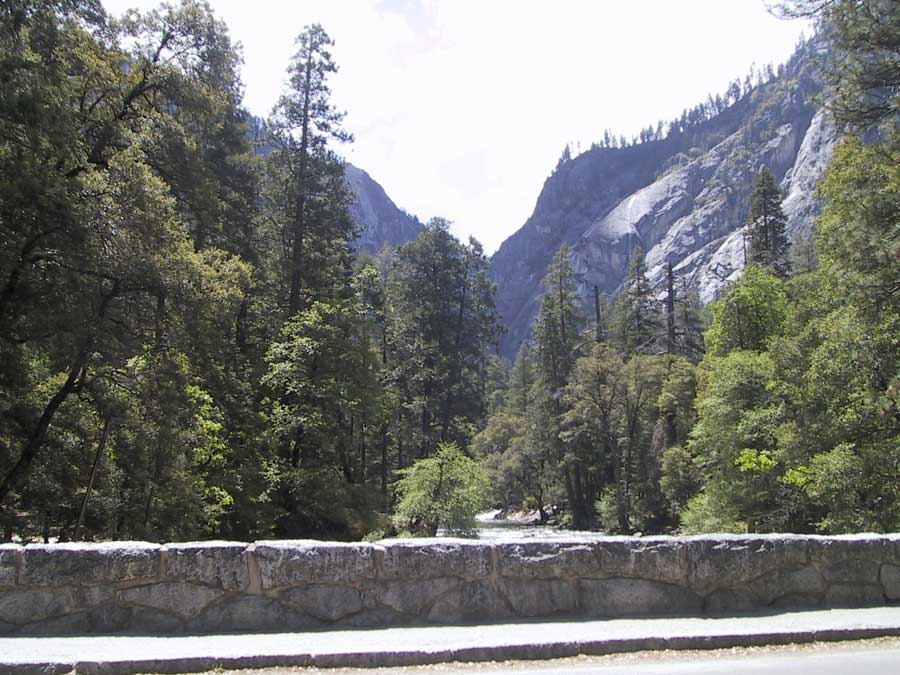
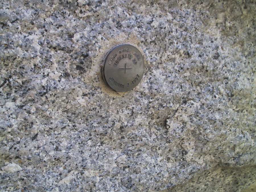
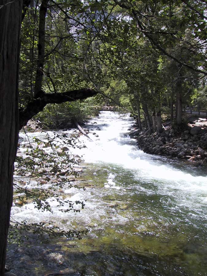
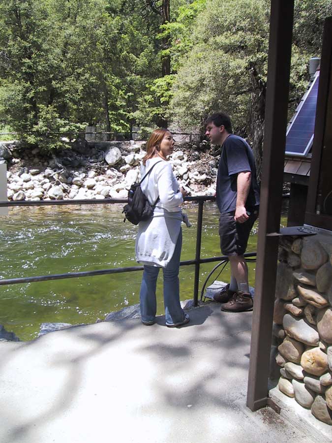
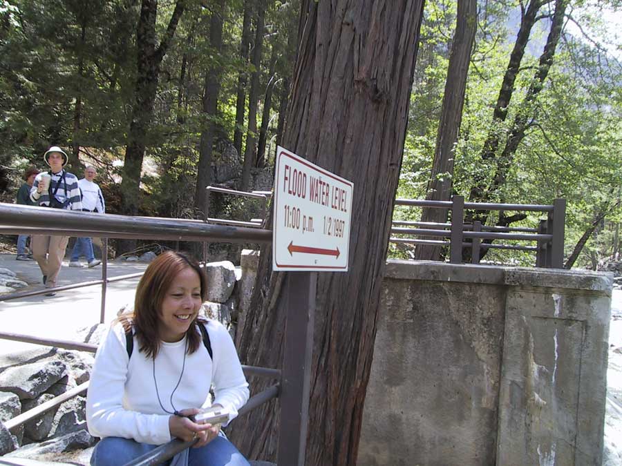
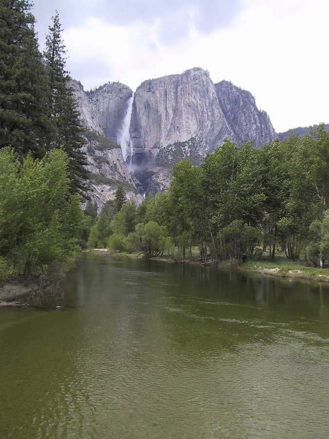
Yosemite Valley High Water – The 100 Year Flood
N 37° 44.790 W 119° 35.775

link to the geocaching website

Not too long ago, Yosemite Valley experienced a remarkable wintertime flood resulting from unseasonable warm rains on top of a substantial early snow pack. This easy 2-mile loop introduces visitors to the heart of the valley and seven waypoints that reflect some of Yosemite’s most scenic wonders.

The 100 Year Flood was a once in a lifetime experience. Team Gecko happened to be visiting immediately prior to the flood during their nearly annual winter visit in the valley. The tropical rains began a day or so before our departure. The flood resulted from 10 inches of rain over a 6-day period that melted a substantial portion of the snow pack up to the 11,000 foot elevation level. Some of the resulting damage and changes to the valley and Merced River canyon were extraordinary – at least in human terms. Of course, Yosemite Valley has witnessed many and more dramatic natural events over the millions of years of its formation and sculpting.

To complete this virtual cache, you will walk or bike or ski or snowshoe around a well-marked path in the heart of the valley. Parking is available very close to the posted coordinates for Waypoint 1. You may also ride one of the free Yosemite shuttle buses from any of the regular pickup points to this starting location. At each waypoint, you will find clues that allow you to determine coordinates for the next waypoint. To confirm successful completion of the course, please email your responses to the questions asked about each stop.

Special note: GPS reception in the valley can be variable at times, especially in forested areas and on the south side. Many of these reference coordinates are rounded to nearest .005. The respective waypoints should be reasonably obvious once you are this close to their true positions.

Waypoint 1: N37° 44.790, W119° 35.775
Only a few yards from parking, this sign features a historic photo taken about 1890 of the Yosemite Village site when it was home to the largest Miwok village in the valley. What was the name of the village? Hint: It starts with the letter K. Also on the sign, the date the U.S. Army took over this location is noted as 19a6. Please use the number represented by the letter a to compute the next coordinates.

Waypoint 2: N37° 44.45a, W119° 36.a00
This site introduces you to a metal sign on a wooden post of a type that will become familiar to you over the course of your tour. It shows the maximum height of the flood at selected locations. It also shows the corresponding time and date as 11:00 p.m. b/c/9d. As before, you will use the numbers represented by b, c, and d to provide you the information needed to compute later coordinates. At a bearing of 240 degrees magnetic, what is the two-word name given the closest building? Hint: the second word is Center.

Waypoint 3: N37° 44.c10, W119° 36.000
You can follow a bike trail or a riverside path to this location. Here you will be suspended over the famous Merced River, the main watercourse through Yosemite. The damage it caused to valley campgrounds, Yosemite Village, Yosemite Lodge, and the several communities downstream from the park are documented in a popular booklet titled Yosemite: The 100 Year Flood, Movement in Tides. It is available for purchase for $6.00 in the Yosemite Park Visitor Center and the lodge gift shop. At the Waypoint 3 coordinates, you should see a gray sign that warns against certain behavior. What two activities does it indicate are prohibited? Extra credit: What is the name of this bridge?

Waypoint 4: N37° 44.485, W119° 35.e10 where e = d - c
This is also a flood level sign. It is immediately adjacent to a wooden sign that shows days and times. What regularly scheduled events does the wooden sign announce? How many 1-inch wooden pegs were used to construct it? Hint: all pegs have two ends but not all of these pegs show both ends.

Waypoint 5: N37° 44.495, W119° 35.e20 where e is the same as for Waypoint 4
These coordinates lead you to another informative sign a very short stroll away. It reports on restoration activities not directly associated with this flood. What was previously located here and was moved? The dates of the moves are recorded on this sign as 19f9-19g3.

Waypoint 6: N37° 44.gf2, W119° 35.402
You are now viewing another flood marker sign and should be viewing one of Yosemite’s most famous natural features in front of you. A short distance in the opposite direction – to the southwest – is an interpretative sign about the nearby stone bridge. What is the name of this bridge? How many times does it say the bridge has been replaced?

Waypoint 7: N37° 44.d52, W119° 35.d43
By now, you should be very familiar with the date and time of the highest water. The number represented by d was originally revealed back at Waypoint 2. You will see it again at Waypoint 7, which should be a short distance from where you started. In fact, from here, you could easily catch a ride. What is the single digit number on the adjacent transportation sign?

This completes the tour of Team Gecko’s High Water virtual cache. We hope you enjoyed navigating the course. Have a pleasant and enriching 
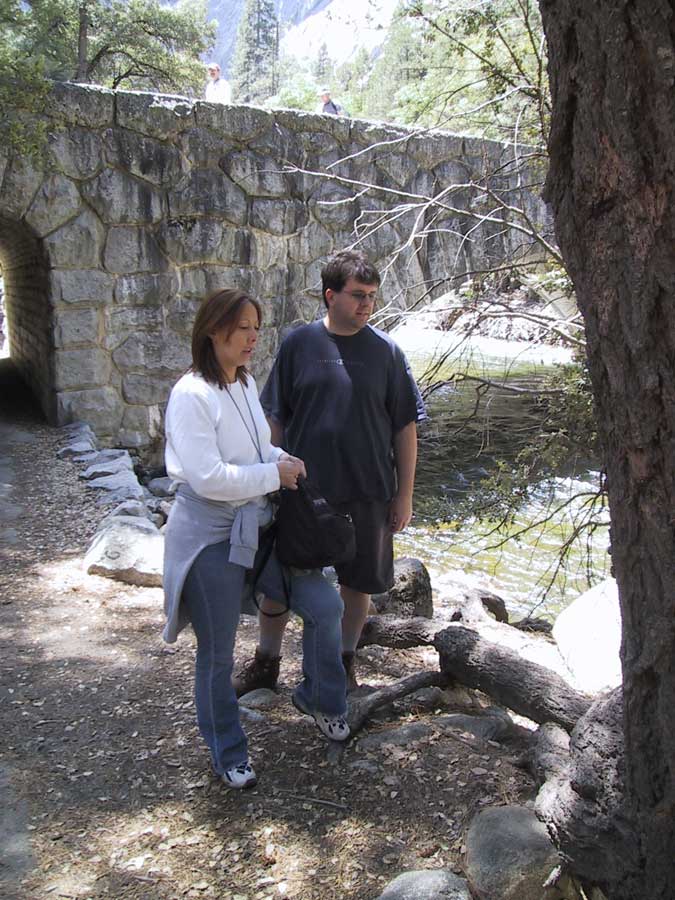
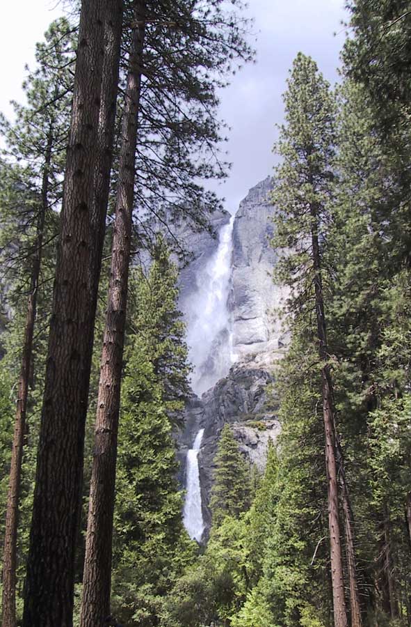
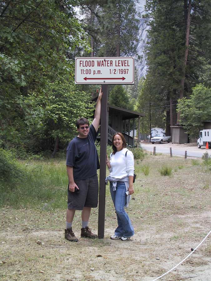
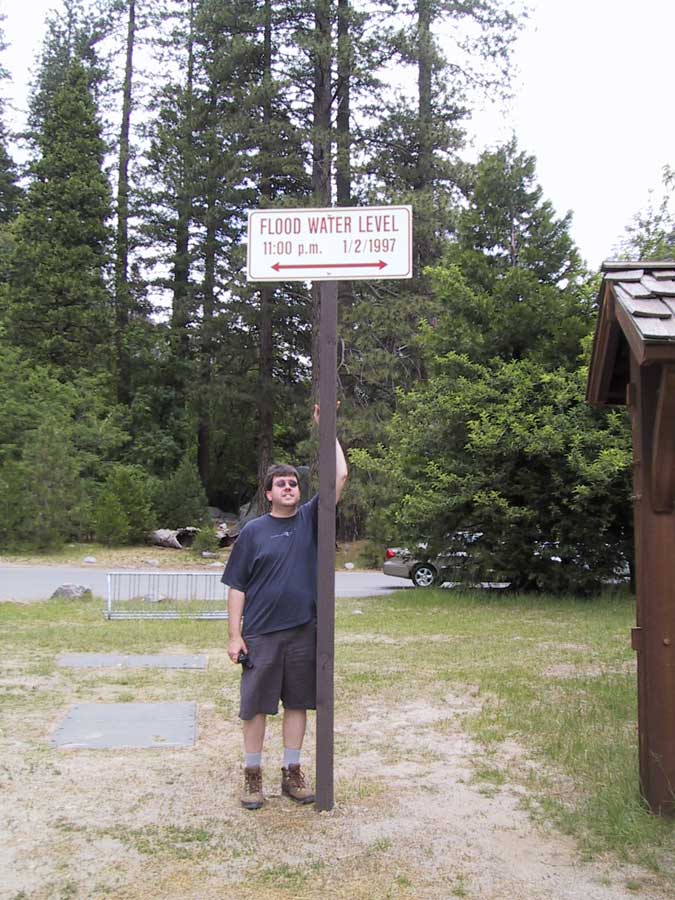
time during your visit to Yosemite National Park.
 

This was the most complex geocache we've done so far. Having all of the different way points, and having to solve the puzzle to get certain waypoint numbers was a lot of fun!

We luckily got off the correct bus stop and headed towards the first coordinates. We easily found the answers, and while we were there headed up to lower Yosemite Falls. After that, we headed to waypoint 2-7. The trail that this cache led us on was great because there were tons of amazing views along the way. Plus we were shocked at how high the water level was on January 2, 1997. During breakfast that morning, Nancy was telling us about stories that employees at the Awahnee told her. How there was so much water coming off the granite cliffs that it looked like reverse bathbub flowing into the valley. Everywhere you looked, the granite walls were pouring water, everywhere was a waterfall.

Answer to Waypoint #1

Yosemite Falls

At Waypoint #2

Answer to Waypoint #2

Answer to Waypoint #3

On Swinging Bridge

View of Yosemite Falls from Swinging Bridge

At Waypoint #4

Answer to Waypoint #4, part 1

Answer to Waypoint #4, part 2:

Linda and Jimmy count out the pegs

Answer to Waypoint #5

Answer to Waypoint #6

No picture of the Answer to Waypoint #7

because we started off there: Bus Stop #6!


Our Log:

 May 21 by jretz (16 found)
Wonderful cache!! It was a great walk to see parts of the valley that we wouldn't have explored if it weren't for this very interpretive hike. The views along this hike were spectacular. I'd recommend this to anyone who wants to explore the valley floor, see a lot of amazing sites and learn more about the flood.


May 22, 2004

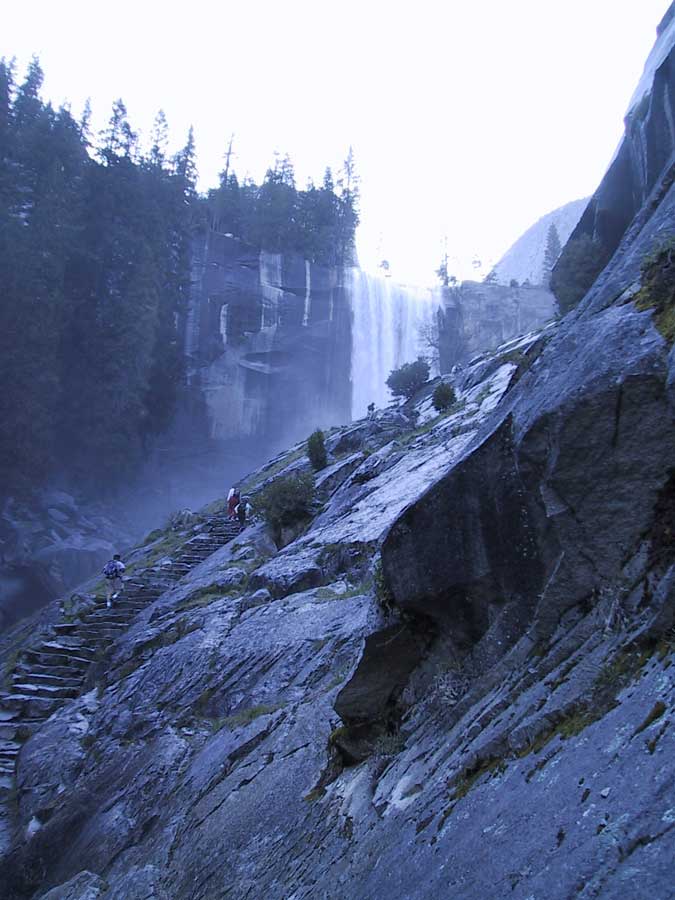
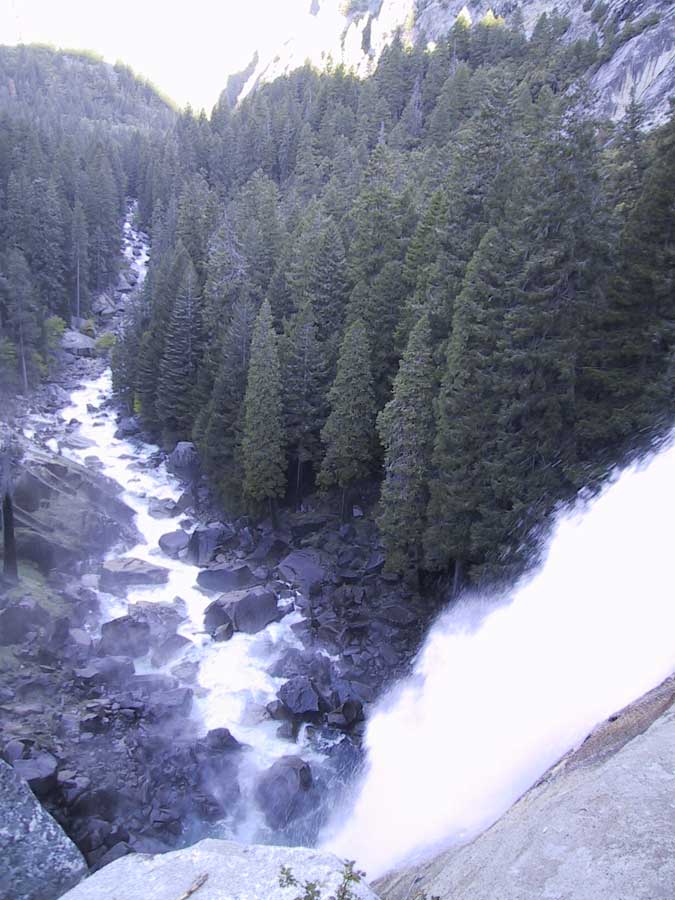
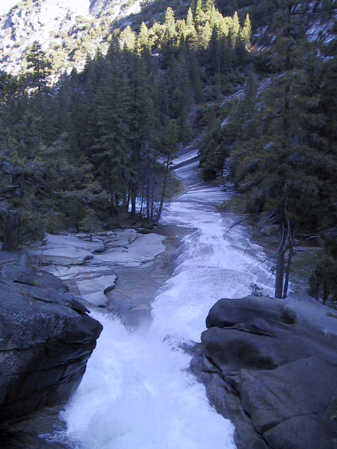
Today was the day of the "Big" hike. About 50 of our group were going on the trail to Half Dome. Many would go all the way to the top, some would go at their own pace and go up as far as they wanted. Most of us left Curry Village at 5:30 in the morning and walked to Happy Isles. Around 6:15, Jimmy and I headed up Mist Trail with Linda, Vanessah and Stan. We all climbed it at our own pace. It wasn't drenchingly wet, but definitely wet enough to warrant a poncho, at least in mine and Jimmy's opinion. Yesterday, we knew that this cache was up here, but since it was so early and we were concentrating on the hike, we forgot about it till we got home. Luckily we knew the answers so we could log our find.

Mist Trail Cache

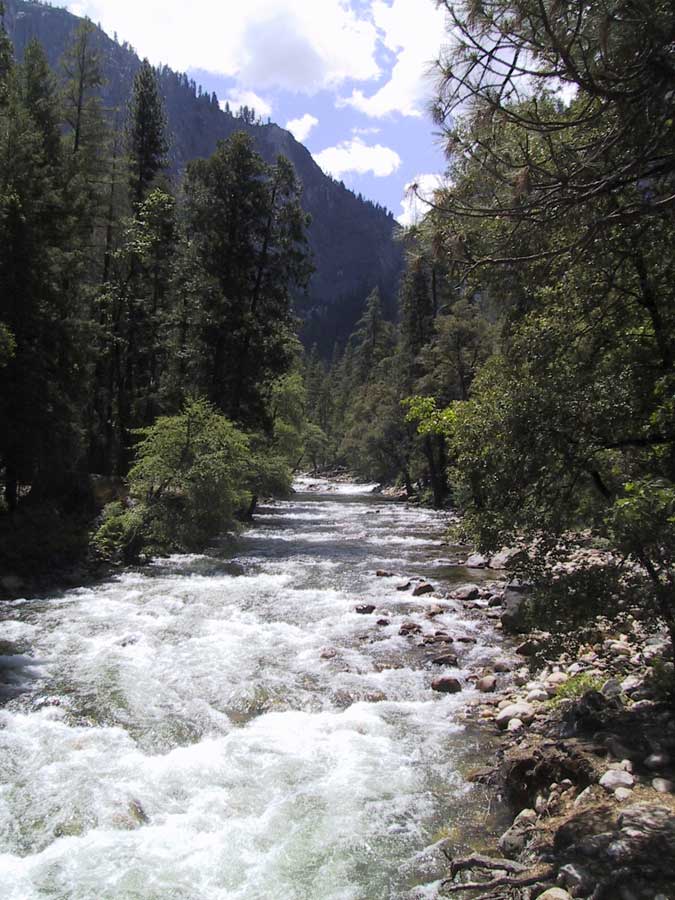
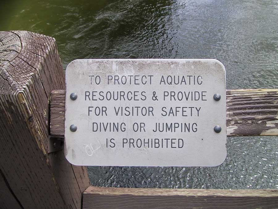
N 37° 43.636 W 119° 32.599

link to the geocaching website

This virtual cache is located at the top of the Vernal Falls Mist trail. Finding the virtual cache is relatively easy, getting there is a little harder, and very wet!

Take a nice hike up the Vernal Falls Mist trail to find this virtual cache and a nice view from the top of the Vernal Fall. The trailhead we started at was about 1 mile south east Curry Village, but there are numerous other ways to get to this cache.

To log this cache, please identify the two bodies of water you are prohibited from swimming in. Have fun, and watch your footing when the water is running! Don't worry about emailing me to confirm the bodies of water, I trust that geocachers are honorable people. However, feel free to email me with pictures or comments about the hike. Enjoy!


At Vernal Falls Bridge

Climbing Up Mist Trail

Looking down Vernal Falls

Silver Apron

Nevada Falls

 
Our Log:

 May 22 by jretz (16 found)
A group of about 50 of us started this hike at 5:30 am. Many headed up to half dome, some just went at their own pace and enjoyed the views. About 1/2 went up the mist trail, the others went up John Muir. We enjoyed finding a cache along the way.
The two of us used our ponchos as we climbed up Mist Trail, and it was quite wet, but not drenching. Very cold at 6 am, though!!
If you're interested, you can visit our website for our groups Adventures. No caching information is on this page: http://www.retzlaff.com/yosemite_2004_adventure.htm


© madretz 2004